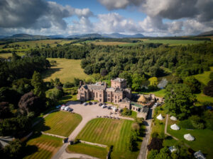
Windermere may be England’s largest natural lake but the runner-up, Ullswater, is far superior. Controversial? No, just a fact! And it’s easy to prove it; simply lace up your boots and walk…
Award-winning guidebook writer and photographer Vivienne Crow has come up with ten walks – all accessible by Stagecoach buses 508 and 509 – that explore the valley and surrounding areas. They range from a 90-minute lake circuit to a classic scramble on Helvellyn.
Stagecoach has enhanced timetables in the Ullswater valley in 2026, with the 509 now running daily, making planning adventures on the fells easier than ever. In addition, the Sustainable and Integrated Transport for Ullswater (SITU) funded ‘Ullswater Hopper‘ UB1 and UB2 services provide direct links to Pooley Bridge from the main accommodation sites around the lake, meaning the car can stay at home.
The maximum price of a single ticket is £3, and all English concessionary bus pass holders travel for free on Stagecoach buses.
For bus times, go to the Stagecoach website or download the Stagecoach Bus app from Google Play or Apple’s App Store.
Walk 1: Place Fell
Start/finish: Patterdale
Length/ difficulty: 4½ miles; moderate/hard; approximately 3¼ hours
Map: Ordnance Survey OL5, English Lakes NE
One of the easier-to-reach Wainwrights, Place Fell is a relatively short walk from Patterdale. That’s probably why it’s such a popular summit – that and the fact that it’s perfectly placed for standing and gawking at Helvellyn and its gnarly neighbours on the other side of the Ullswater valley. Whenever I climb it, I avoid the main path from Boredale Hause and take the Hare Shaw route up, a much quieter trail. Accessed via a beautiful balcony path above Side Farm, it ascends the juniper-covered front of Place Fell and then loops back round to approach the trig pillar stealthily from the less-trodden north. There’s a good chance you’ll have this approach to yourself – which means a better chance of spotting the red deer that frequent these slopes – but you’ll almost definitely have to share the summit. From here, descend the clear path to Boredale Hause and then join the route of the Coast to Coast National Trail back to Patterdale.

Walk 2: Helvellyn
Start/finish: Glenridding
Length/ difficulty: 9¼ miles; hard; approximately 6¼ hours
Map: Ordnance Survey OL5, English Lakes NE
Having gazed longingly at Helvellyn from Place Fell, you’ll probably want to take on England’s third highest mountain at some point. There are dozens of routes up it, the 508 and 509 buses providing access to those from the east. So, which way to go from there? Through the magnificent glacial valley of Grisedale? Off-piste up the front of Nethermost Pike? Along precipitous Striding Edge? In good weather, Swirral Edge is a superb alternative to the latter; it’s less exposed than the crest of Striding Edge, it’s shorter and it’s not as crowded. You’ll need to be comfortable on rock though and have a good head for heights. Climb Catstye Cam first to get a feel for narrow ridges and then make your way along the spiky arête, scrambling in places before a loose, stony exit trail rises to the summit plateau. From here, the descent is a relaxing counterpoint to the walk’s challenging first half, using the switchback ‘pony route’ to drop into the valley.

Walk 3: Dalemain Loop
Start/finish: Pooley Bridge
Length/ difficulty: 5 miles; easy; approximately 2½ hours
Map: Ordnance Survey OL5, English Lakes NE
Take a break from the fells to savour the rolling pastures and woodland to the north of Pooley Bridge. The ‘Dalemain Loop’ is a five-mile circular walk that was added to the popular Ullswater Way a few years ago. The signposted route passes through woodland along the base of Dunmallard Hill – crowned by an Iron Age fort – before heading out across farmland with impressive views of the North Pennines and the eastern Lake District fells. After visiting the village of Dacre and its enigmatic churchyard bears, the route continues to the historic mansion of Dalemain before heading south again to pick up a gentle trail beside the River Eamont that leads back to Pooley Bridge. There are opportunities for breaks along the way, with the Horse and Farrier pub in Dacre open for lunch every day except Monday and Dalemain’s barn being home to a tearoom (closed Saturdays). Or keep going and then take your pick from several pubs and cafés in Pooley Bridge at the end of the walk.

Walk 4: Ullswater shore and Cockpit Stone Circle
Start/finish: Pooley Bridge
Length/ difficulty: 6 miles; easy/moderate; approximately 3 hours
Map: Ordnance Survey OL5, English Lakes NE
Another option, having caught the bus to Pooley Bridge is to head south, soon picking up the path beside Ullswater. This is the Lake District’s second longest lake and its scale quickly becomes apparent as you make your way along its shore, the dark waters snaking away into the distance. The other end of the lake is out of sight, hidden away near the foot of the Helvellyn range. After this waterside start, the walk heads inland, along farm paths, before climbing gently towards Barton Fell. Reaching the base of the fells, you’re on good tracks and lanes for much of the rest of the walk: a chance to enjoy a different perspective on the surrounding countryside including some ‘big sky’ scenery and wonderful views across to the North Pennines. Before descending to Pooley Bridge, the walk visits The Cockpit, a mysterious stone circle that is just one of the many Bronze Age sites scattered across the low moorland here.

Walk 5: Swinburn’s Park and Gowbarrow
Start/finish: Aira Force
Length/ difficulty: 7¾ miles; moderate; approximately 4¼ hours
Map: Ordnance Survey OL5, English Lakes NE
This sublime route near the shores of Ullswater only takes a few hours but, in that time, there’s a huge amount of variety: walkers get to see a beautiful arboretum, one of the Lake District’s most spectacular waterfalls, isolated cottages, ethereal forest, open fell and a view that is among the best in the National Park. It begins by heading up the Aira gorge, past Aira Force and with magnificent trees towering overhead. Beyond the trees, tracks and quiet lanes are followed around the back of Gowbarrow Fell and up and over The Hause. (Wainwright baggers might want to make a detour here to ‘tick off’ Little Mell Fell.) After passing beneath Priest’s Crag, the route crosses Swinburn’s Park and enters Gowbarrow Park. Saving the best for last, it rounds a bend above Yew Crag… Suddenly, there’s Ullswater below, its sparkling waters leading the eye towards the magnificent Helvellyn range in the distance. Even though I know it’s coming, that view never fails to stop me in my tracks.

Walk 6: Glencoyne
Start/finish: Glencoyne Bay
Length/ difficulty: 6¾ miles; moderate/hard; approximately 4 hours
Map: Ordnance Survey OL5, English Lakes NE
For me, a walk in the Glencoyne area is like stepping back in time. From the bus stop at Glencoyne Bay, you turn your back on the road and begin climbing into the past. Ahead, the stone barns and circular chimneys of Glencoyne Farm – parts of which date back to 1629 – seem to be as much a part of the landscape as the beckside trees and the rugged dalehead beyond. The route passes the old miners’ cottages at Seldom Seen and traverses the base of Sheffield Pike before a narrow trail swings north, tottering across Glencoyne Head. The timeless drama of this rocky amphitheatre, filled with the roar of the becks, is a world away from the fleeting concerns of 21st-century humans. As the valley opens out again, we enter Glencoyne Park where birch, beech and oak grow at a surprisingly high altitude. Lower down, native cattle graze among the scattered trees and between thickets of bramble, hawthorn and blackthorn. Known as wood pasture, this sort of habitat was once common throughout the Lake District.

Walk 7: Grisedale
Start/finish: Patterdale
Length/ difficulty: 7 miles; moderate; approximately 3¾ hours
Map: Ordnance Survey OL5, English Lakes NE
Many of the Lake District’s most distinctive landforms were carved out by glaciers. Waterfalls, arêtes, even the lakes themselves owe their existence, in part, to the action of ice many millennia ago. One of the most common glacial features are the u-shaped valleys, including Grisedale which slices between the Helvellyn and Fairfield fells in spectacular fashion. It can be easily explored from Patterdale, first by heading up its northern side, where enormous boulders line the path, some still bearing the scars of the ice’s abrasive forces. As you progress upstream, the scenery feels increasingly hostile as the valley’s walls close in around you, rising eventually to the hidden coves of the Helvellyn range. Continue as far as Ruthwaite Lodge, or Grisedale Tarn if you’re feeling energetic – either makes a good picnic spot before you head back. On the return route, the Coast to Coast National Trail can be followed downstream through a more benign, pastoral landscape, passing small patches of woodland and sheep-filled meadows.

Walk 8: Brothers Water and Hartsop
Start/finish: Hartsop
Length/ difficulty: 3 miles; easy; approximately 1½ hours
Map: Ordnance Survey OL5, English Lakes NE
From March to November, the 508 usually continues beyond its Patterdale terminus to Hartsop, the Kirkstone Pass, Troutbeck and, finally, Windermere – and the final three walks described here can all be accessed using this seasonal extension. Hop on the bus and ask the driver to drop you at Hartsop. Having wandered round this little hamlet, full of gorgeous cottages, set off on a circuit of Brothers Water. This tiny lake, surrounded by towering fells, was probably once part of Ullswater before alluvial deposits washed down the mountainsides and separated the two bodies of water. Formerly known as Broad Water, it was renamed in the 19th century after two brothers drowned here. The whole walk will only take about 90 minutes – unless, of course, you decide to call in at the Brotherswater Inn, conveniently located about half-way round.

Walk 9: Red Screes circuit
Start/finish: Kirkstone Pass
Length/ difficulty: 9¾ miles; moderate/hard; approximately 5¾ hours
Map: Ordnance Survey OL7, English Lakes SE
Walking around the base of a fell is a great way to develop a more interesting relationship with it. Although you never go anywhere near its summit, you learn to appreciate it more fully and enjoy constantly changing views as you cross from one valley to another. This circuit of Red Screes starts from the top of the Kirkstone Pass and begins by heading downhill, following the trail along the base of Red Screes’ boulder-strewn eastern slopes. After crossing the nose of Middle Dodd, the first real climb of the day begins – up through Caiston Glen. Beyond Scandale Pass, the roller-coaster excursion dips suddenly, descending to Scandale, another of Lakeland’s glaciated valleys. Ambleside is the lowest point on the walk, providing walkers with a choice of pubs and cafés in which to refuel before the climb back up the pass. The return leg starts from Stockghyll Force. In the 19th century, the local community bought these waterfalls and the surrounding woods from a belligerent landowner intent on keeping the ‘hoi polloi’ out.

Walk 10: Troutbeck
Start/finish: Jesus Church, Troutbeck
Length/ difficulty: 5½ miles; easy/moderate; approximately 2¾ hours
Map: Ordnance Survey OL7, English Lakes SE
Is Troutbeck the most idyllic dale in the Lake District? I think so. With its drystone walls snaking up the fells and its traditional cottages and farmhouses lining the valley sides, there’s nowhere quite like it. Don’t take my word for it though; when the A592 reopens, take the bus to Troutbeck’s Jesus Church and explore for yourself. Start by heading up the eastern side of the valley, briefly flirting with wilder and more remote country at the foot of the steep-sided fells of the Kentmere Horseshoe. The children’s writer and conservationist Beatrix Potter loved this area. She described it as “a place of silences and whispering echoes”. In 1923, when she learned of plans to build new homes on the valley floor, she bought 1,875 acres of farmland to prevent the development. Troutbeck Park, the farm she purchased, is passed on the second half of the walk – as is the Mortal Man, should you fancy a pint in one of Cumbria’s prettiest pub gardens.